The objectives of OMIV are to provide to the scientific community consistent and harmonized monitoring datasets that will allow:
- to document and learn more on the physical processes that control landslide dynamics,
- to use these dataset to develop and validate landslide deformation/propagation models,
- to extract patterns that may characterize changes in the landslide response to forcing and propose possible forerunners,
- provide benchmarks datasets for the development of original landslide investigation methods.
The OMIV landslides are monitored using a multi-technique approach.
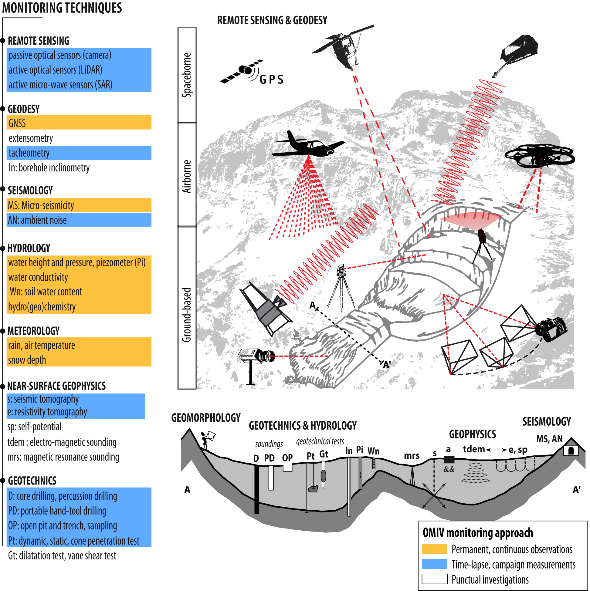 |
|
OMIV multi-technique monitoring approach |
OMIV has the responsibility for data acquisition and distribution:
- on 4 sites in the French Alps (La Clapière, Séchilienne, Super-Sauze, Mas Avignonet)
- for 4 categories of observation (deformation, seismology, meteorology, hydro-geochemistry)
In 2017, SNO-OMIV operates 16 GPS (12 dual frequency, 4 low-cost single frequency), 60 tacheometric benchmarks, 50 vertical (1C) and 14 three-component (3C) seismic sensors, 7 meteorological stations, 7 hydrological stations (with different parameters), and 11 water sampling points.
The detailed objectives of OMIV are:
- To maintain on the long-term the recording of these four categories of observation on-site,
- To develop the same acquisition protocol on the monitored landslides (measurement techniques, space and time data acquisition frequency, quality control criteria),
- To validate, store and provide an open access of the raw data to the scientific community,
- To propose advanced products in the form of time series of displacement, time series of hydro-meteorological observations, and seismic catalogues.