 |
 |
 |
 |
Data processing
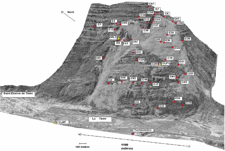
The topographic monitoring of the slope surface displacements is performed thanks to an innovating and autonomous system relies on infrared tacheometric measurement (Leica tacheometer) for the three dimensions positioning of prism reflectors installed on the slope. The tacheometer measures angles and distances for several tens targets located inside and outside the landslide. The accuracy of the measurement is assessed to be around 0.5 to 1 cm for distances reaching more than 1,500 m. The recorded data are communicated for analysis to the CEREMA Méditerannée by radio waves.
 |
|
Repartition of the targets on the La Clapière landslide (background: DEM provided by the CEREMA Méditerannée, 2002) |
For La Clapière landslide example, from 2003.5 to 2006.5 (the latest year for available data), we dispose of raw data we analyzed in order to obtain reliable results about displacements. Thus we calculated for each target and each time step the Lambert coordinates and the corrected distance at the tacheometer.
From these data, this is possible to calculate a target average velocity over the measurement years. All the velocity values allow getting a whole view of the recent kinematics of the landslide.