


Presentation
 |
 |
 |
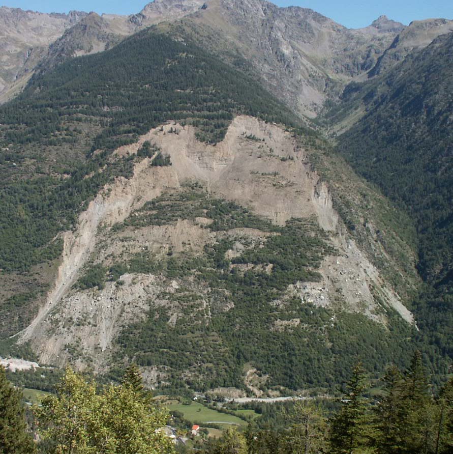 |
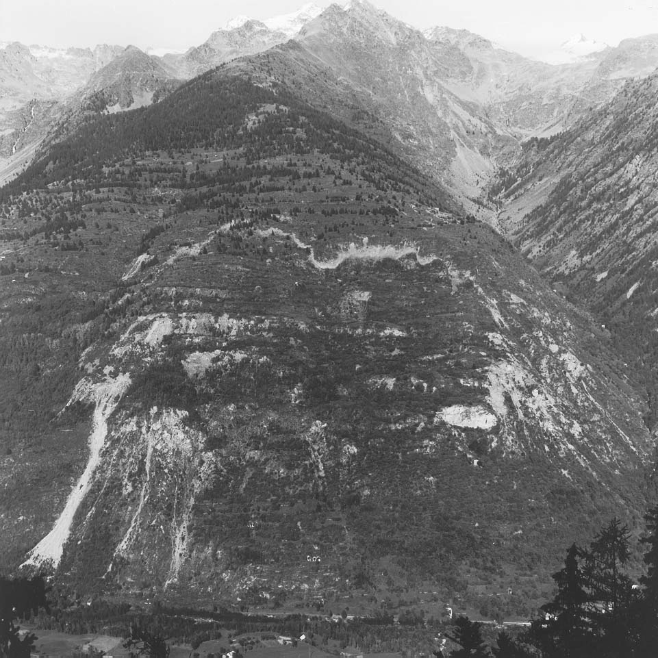
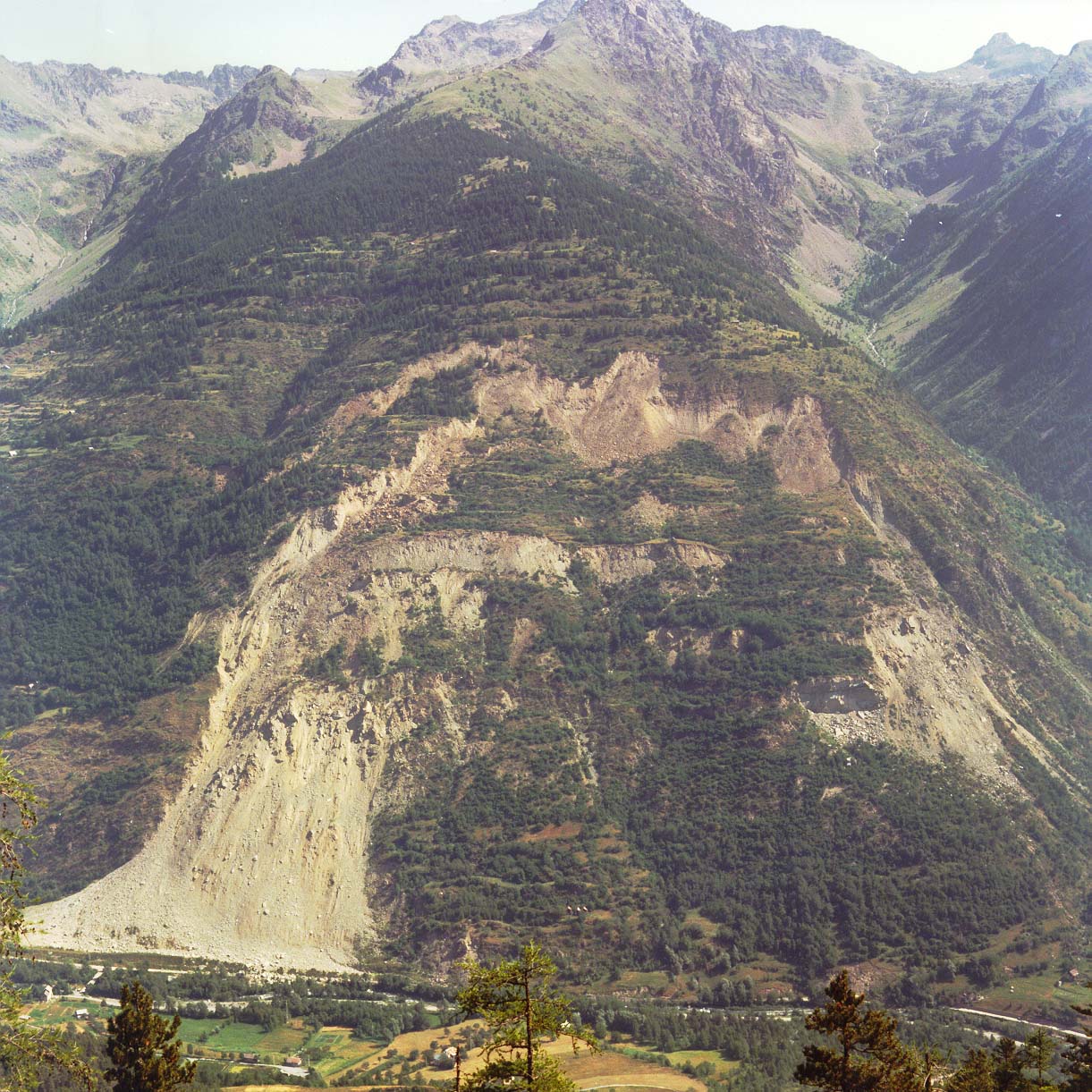
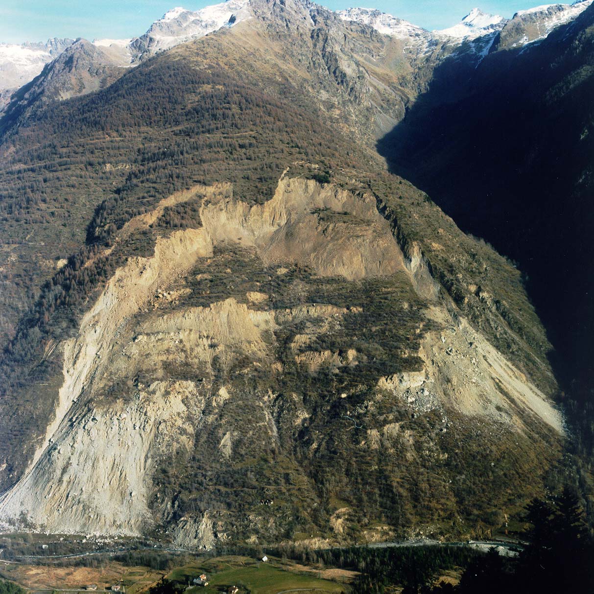
| 1976 | 1988 | 1994 | 2006 |
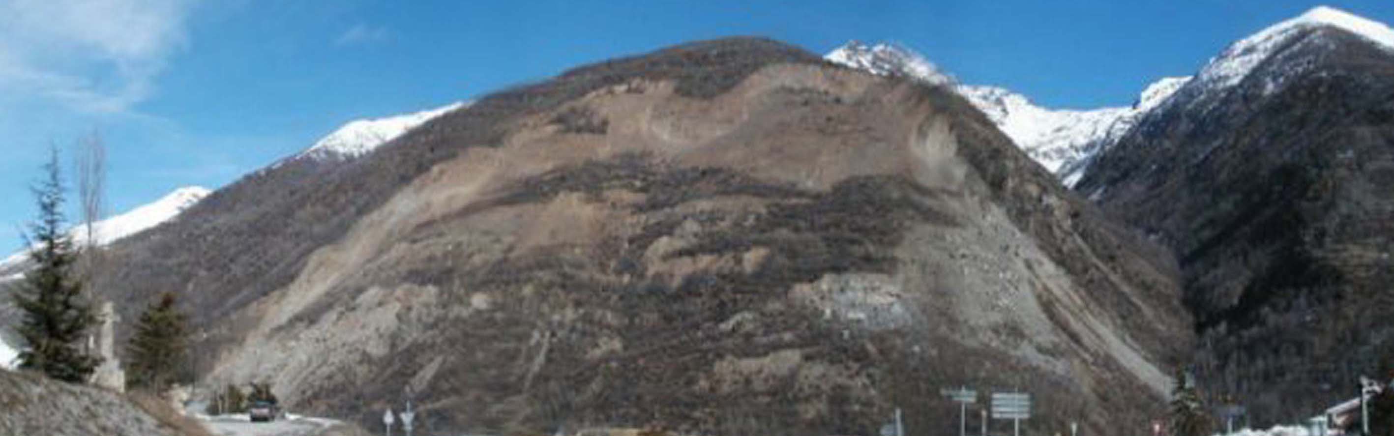
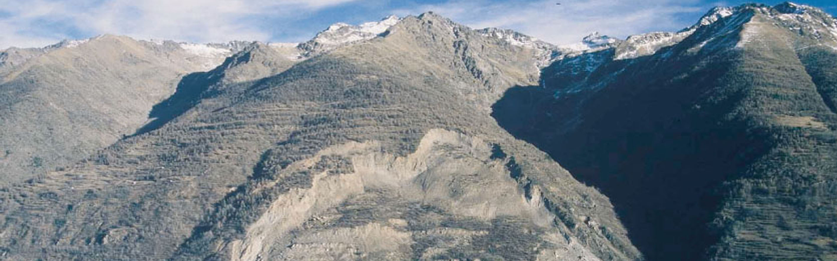
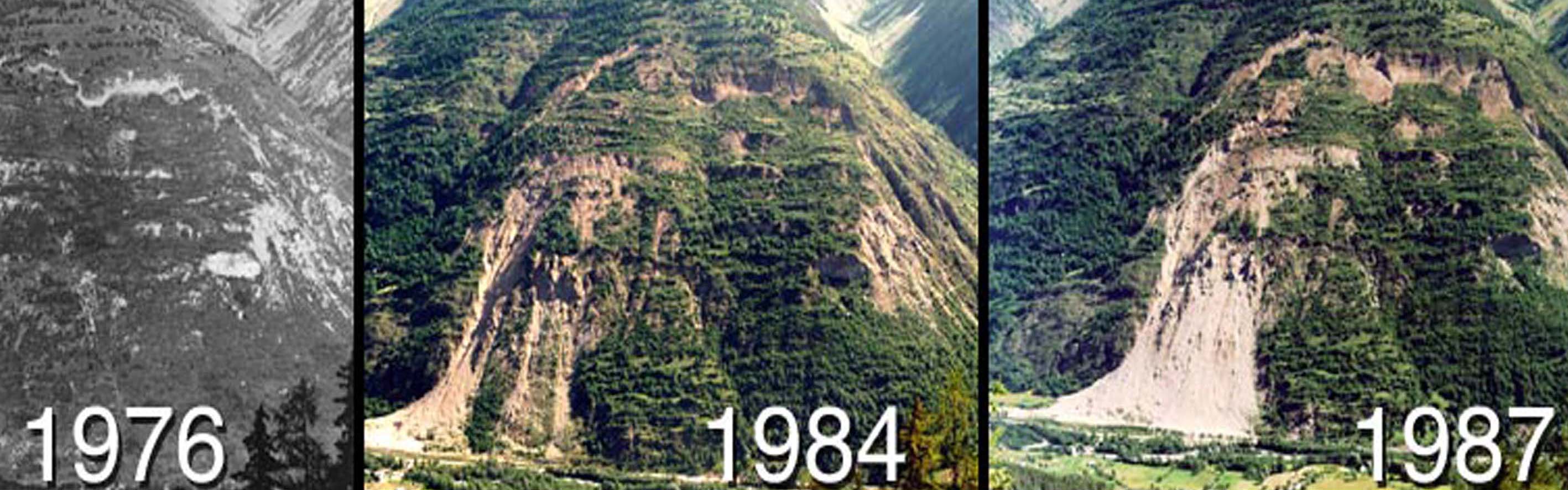
Regarding the landslide dimensions, 1,100 meters long and 750 meters high, and its volume around 60 million cubic meters, the La Clapière landslide is considered as the most important landslide in Europe.
The main scientific issues rely on the understanding of kinematics, mass movement mechanism, and the interactions between external forcings and failure dynamics. While the La Clapière landslide has been slowing down since 2000, it is showing seasonal increasing phases and new upper areas likely to move. The latest studies H. Jomard, 2006 and S. El Bedoui et al, 2009 defined the La Clapière landslide as the visible and active part of a larger mass (Colle Longue DSGSD). Taking into account the whole movements including the most important ones that occured in 1987, we can notice that the measured surface velocities in limited time period and space reach more than 100 mm per day, i.e. an estimated annual displacement rate equal to more than 15 m per year.
Since the 2000s it seems the general displacement of the slope has been slowing down although few more active phases are described, in particular in 2001 and probably in 2009 because of exceptional cumulated snow recordings, superior to 8 m. A geomorphology monitoring is carried out on the fringe of the slide regularly, that shows a weak upper propagation of the recent deformations (nevertheless significant with regard to risk prevention). At the time the generalized sliding movement seems to make way for a progressive breakdown of the slope into sheets related to the lenticular structures. Thus the morphology seems slightly affected. For a few years the landslide has shown a heterogeneous evolution with ’stabilized’ parts (slope foot, where rock falls remain) and still mobile parts (NE upper part).
The origin of the landslide has been one of the scientific issues among the stakeholders since the occurrence of the first main disorders and in particular since the 1987 crisis. It is still subject for debates. The assumptions that are the most often put forward associate pre-disposal factors and triggering factors:
- the decompression of the slope following the smelting of the Tinée Valley glacier
- the thinning down of the Iglière bar in the Rabuons Valley, put forward as a pre-disposal factor even if the structure is usually described as an anchorage point of the slope
- the dissolution of Triassic gypsum at the slope foot (F. Compagnon et al, 1997)
- the intensity of the structural pre-rupture (fractures at all scales)
- erosion by the Tinée River at the slope foot
- hydromechanical behaviours over a long period (F. Cappa et al, 2004 ; Y. Guglielmi et al, 2005)
The majority of authors agree on the statement that the La Clapière existence has its origin in the superimposition of unfavourable factors and throw out the assumption of a unique cause. The latest updates set up by H. Jomard et al, 2007 allowed to include the slope into the Colle Longue DSGSD. Thus the site associates a ’recent’ catastrophic movement in terms of geological times with a post-glacial gravitational deformation, i.e. a gravitational deformation over 10,000 years.
The Tinée landscape features result from both:
- its ancient tectonic inheritance (Variscan to Alpine)
- its recent history (Quaternary) characterized by outstanding climate changes (deglaciation) and a high occurrence of major gravitational phenomena
Click marker for link to sensor description.
Risk and majors stakes
Because of its dimensions and of the materials volume which threatens to collapse and with measured surface velocities more than 100 mm per day in the 1980s, this landslide is one of the fastest in the world and the most important of Europe in term of volume. Hence, it has needed specific integrated management:
- the detour of the former road leading to the village (nowadays buried under the slope foot)
- the building of a diversion tunnel for the Tinée River
The diversion tunnel is an overspill gallery (sized for a 10 year return period flood) 2,500 m long, built on the right bank of the Tinée River. The purpose of the structure is to prevent from risks that should be generated by the creation of a natural reservoir, in case of mass slide.
Monitoring data
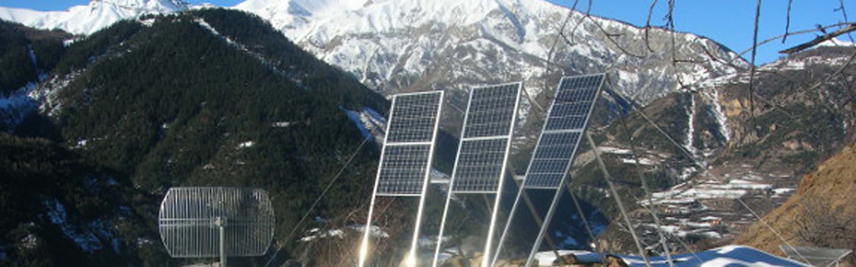
The landslide has been monitored very soon, in a manual way first, then thanks to more and more sophisticated techniques. It was used as a full size experiment for some developing techniques (DORIS at the beginning of the 1990s, automatic tacheometric measurements, photogrammetric measurements, 3D scanner).The fast evolution and above all the ’mass movement’ feature have required the monitoring and the instrumentation of the site. Especially this is based upon a topographic monitoring of the slope surface displacements.
The CEREMA Méditerrannée has been in charge of the monitoring of the landslide since 1982. In 1990, a monitoring system by automatic tacheometer was installed. In 2001, one of the tacheometers was removed: nowadays only one of them remains installed and is located on the Saint Maur site. It achieves automatic measurements every four hours. The measurements are completed by displacement calculations by photogrammetry and DEM comparisons, and recently by a GPS survey. Within the framework of experiments conducted by the European project RETINA, four GPS stations were installed by Geoazur in 2003. Their first goal was to test a cheap and real time means for monitoring landslide movements. The GPS databases are stored by the permanent GPS French national network RENAG.
A warning plan ORSEC can be launched in case of movements assessed as critical.
More details Here.