Presentation
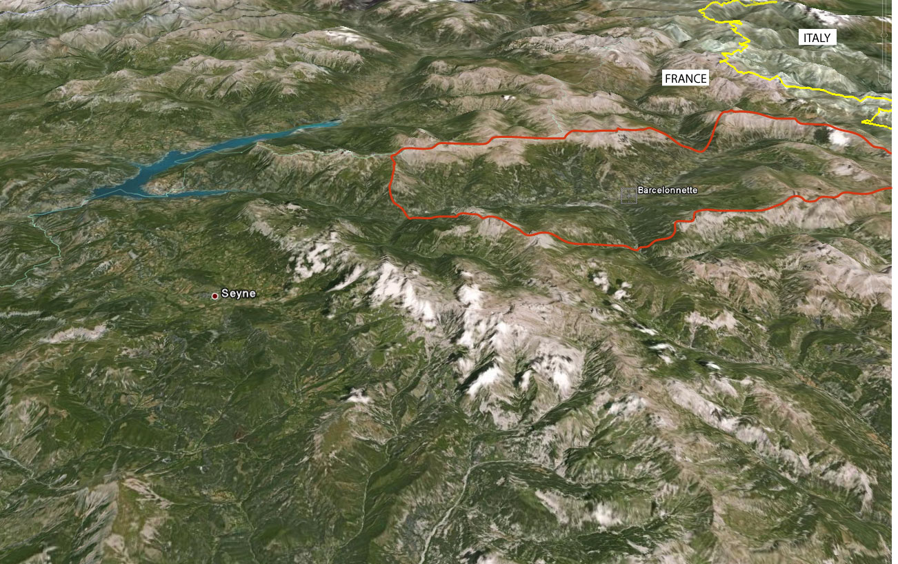
The Ubaye catchment is representative of climatic, lithological, geomorphological and landcover conditions common to several regions of the South French Alps, and is highly affected by landslide hazard. The medium course of the Ubaye river, e.g. named Bassin de Barcelonnette, extends over an area of 200 km², with a length of 22 km (from Jausiers to the East to Les Thuiles to the West), and a maximum width of 10 km. High crests, reaching altitudes from 2800 m to about 3100 m enclose this basin.
 |
|
Location of the Barcelonnette Basin in the South French Alps |
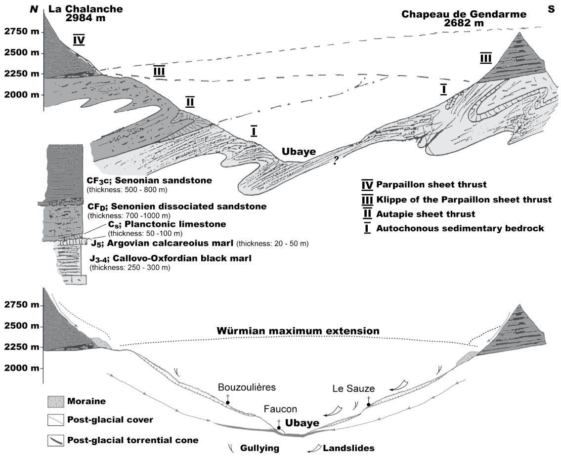
The Barcelonnette Basin is a geological window in two Eocene sheet thrusts (Autapie and Parpaillon), made of strong limestones or sandstones, and overlaying an autochtonous bedrock of soft autochtonous Oxfordian-Callovian black marls. Due to this predisposing geological structure, the hillslopes are affected by severe gullying, shallow landslides, and deep-seated large landslides, some of which directly affecting the local population.
 |
|
Geological and geomorphological cross-section of the Barcelonnette Basin |
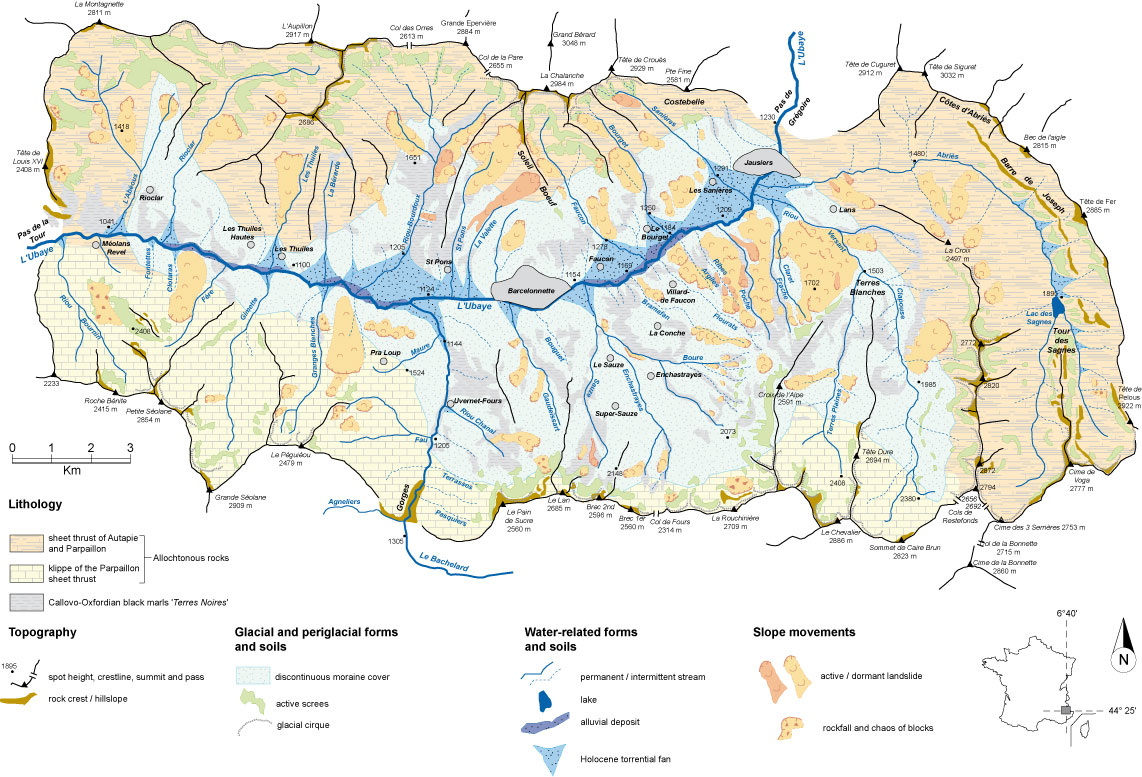
The geomorphological setting is complex, and has a strong control on landslide distribution. In addition to the erosion activity of the glaciers, torrential erosion by the Ubaye river has progressively carved out the landscape.
 |
|
Simplified geomorphological map of the Barcelonnette Basin and location of the main relict and active landslides |
Hillslopes are characterized by very steep slopes (slope gradient ranging between 30° and 70°) and more gentle slopes (slope gradient ranging between 10° and 20°). The relief is irregular, and associates alternating steep convex slopes, regular planar slopes and hummocky slopes:
- the steepest convex slopes (> 35°) are carved in the black marl outcrops and are very often gullied in badlands or affected by rock-block slides or complex slides;
- the regular planar slopes (10°-20°) are made of thick morainic deposits (between 10 and 20 m), are very often cultivated and affected by rotational or translational slides;
- the hummocky slopes are generally covered by forests and/or by natural grasslands.
 |
|
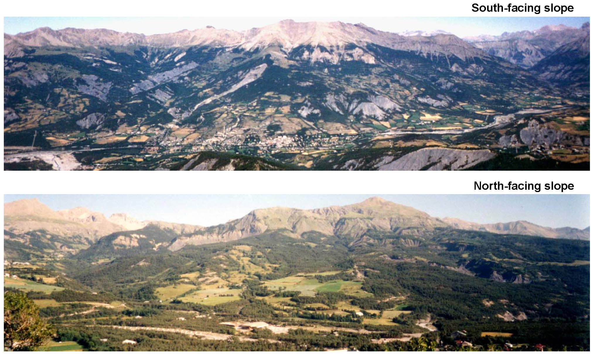
Typical landscape of the Barcelonnette Basin for the South-facing and the North-facing hillslopes |
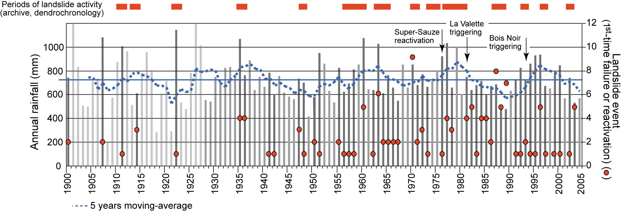
The Barcelonnette Basin has a dry and mountainous Mediterranean climate with strong interannual rainfall variability (733±412 mm over the period 1928–2002), strong storm intensities during summer and autumn (over 50 mm h-1) and ca. 130 days of freezing per year. These characteristics are favourable to the triggering of mass movements. However, landslides are not controlled only by climatic conditions; instability can also occur during relatively dry periods whether or not they were preceded by heavy rainfall. This reveals that landuse changes control also the location of landslides.
 |
|
Climate - Landslide relationships for the period 1900-2005 |
Monitoring data
Since the 1990’s, landslides, debris flows, rock falls, floodings and rock glaciers are investigated by the School and Observatory of Earth Sciences, Institute of Earth Physics (Strasbourg), in coordination with the local risk managers in Barcelonnette (RTM: Restauration des Terrains de Montagne). The data acquired consists in natural hazards catalogues, predisposing factor maps, triggering factors time series and information on the observed damage.